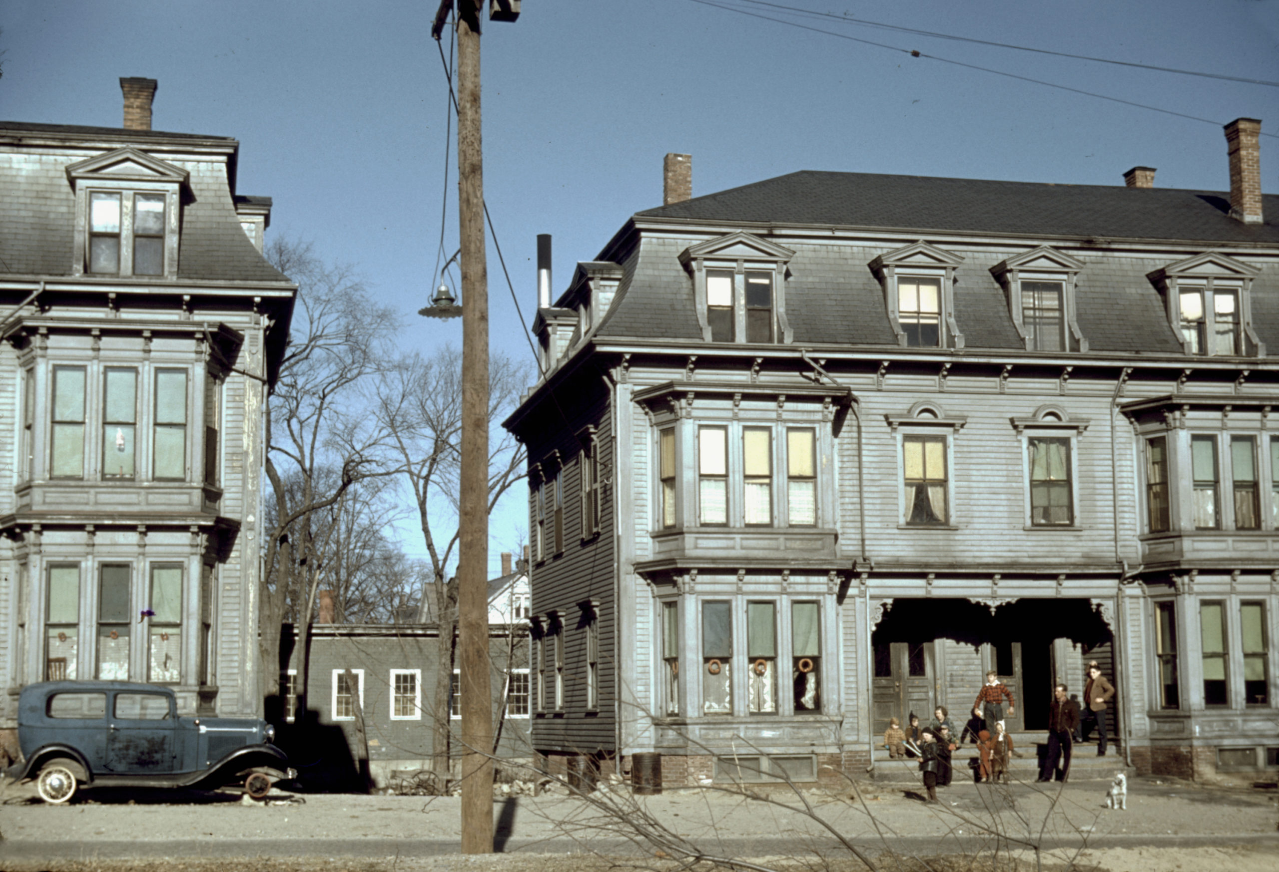
This photo showing children in the tenement district of Brockton, MA was taken by Jack Delano in December, 1940. The building on the left is 14-20 Rosseter St and the one on the right is 22-28 Rosseter St.
More Pictures of Massachusetts
Vintage map of Plymouth Massachusetts from 1910
This map shows Plymouth, Massachusetts as it looked in 1910
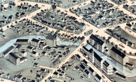
Beautifully restored map of Charlton, MA in 1887
Detailed bird’s eye view of Charlton, Massachusetts in 1887
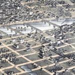
Beautifully restored map of Watertown, MA from 1930
This amazing map of Watertown, Massachusetts was created to celebrate the town’s 300th anniversary in 1930.
This is how West Medford, Massachusetts looked in 1897
This old map shows West Medford as it looked more than 100 years ago
Beautifully detailed map of Woburn, Massachusetts in 1883
Historic bird’s eye view of Woburn, Massachusetts in 1883
Beautifully detailed map of Orange, MA from 1883
Detailed bird’s eye view of Orange, Massachusetts in 1883
Beautifully restored map of Townsend Center, MA from 1889
Detailed bird’s eye view of Townsend Center, MA in 1889
“Avalon”, the majestic mansion of Frederick Ayer in Prides Crossing, MA
The grounds were landscaped by Frederick Law Olmsted, designer of Central Park in…
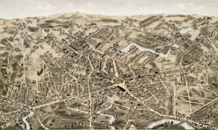
Beautifully restored map of Southbridge, MA from 1878
Bird’s eye view of Southbridge, Massachusetts in the 19th century.
Wonderful old map of Bradford, Massachusetts in 1892
This map shows Bradford, Massachusetts in 1892, five years before it was annexed to the city of Haverhill.
Beautifully detailed map of Martha’s Vineyard from 1954
Historic map of Martha’s Vineyard from 1954
Historical map of Weymouth, Massachusetts from 1880
This amazing map of Weymouth, Massachusetts shows a bird’s eye view of the city as it looked in 1880.
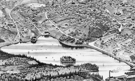
Beautifully restored map of Merrimac, MA from 1889
Historic bird’s eye view of Merrimac, Massachusetts in 1889
Bird’s eye view of Williamstown, Massachusetts in 1889
Click here to see Williamstown, MA in 1889
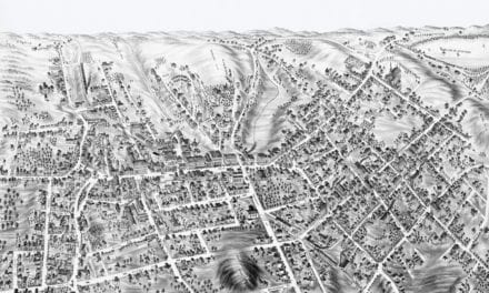
Beautifully detailed map of Hyde Park, Massachusetts from 1879
Historic bird’s eye view of Hyde Park, Massachusetts in 1879
Beautifully detailed map of Ayer, Massachusetts from 1886
Historic bird’s eye view of Ayer, Massachusetts in 1886
Beautifully restored map of East Cambridge, MA from 1879
Detailed bird’s eye view of East Cambridge, Massachusetts in 1879
Beautifully restored map of Foxborough, MA from 1888
Historic bird’s eye view of Foxboro, Mass